
Soil types in Colombia: urban, expansion, rural, suburban and protection
November 8, 2026

Updated November 8, 2026 By Civil Engineer Daniel Horacio Osorio Conde, Grupo D&H y Nacional de Terrenos
Two lots of the same size, in the same municipality, can be worth very different amounts. The reason is almost always... soil class. Urban land can be developed with a permit; rural land cannot be subdivided as in the city; protected land is virtually untouchable. This guide explains the land classifications defined by Law 388 of 1997, their categories, and what they mean for those who buy, build, or invest in Colombia.
Write to us on WhatsApp Call: 310 277 8583
| Class | Brief definition | What can be done |
|---|---|---|
| Urban (art. 31) | Areas with road infrastructure and primary energy, water supply and sewage networks, within the urban perimeter | Build with a license according to urban regulations |
| Urban expansion (art. 32) | Areas that will be incorporated into the city during the term of the plan | Urbanize, usually through a partial plan |
| Rural (art. 33) | Land unsuitable for urban use, intended for agricultural, livestock, forestry or natural resource exploitation uses | Production, owner's residence and permitted uses; limited subdivision |
Within those classes, the law creates two categories:
The national standard on rural land, compiled in Decree 1077 of 2015 (originating from Decree 3600 of 2007), divides rural land into two large groups:
| Cluster | Includes |
|---|---|
| Protection categories | Areas of conservation and environmental protection; areas for agricultural, livestock and forestry production; areas of the public services system; areas of cultural heritage; areas of threat and risk |
| Restricted development categories | Suburban land; rural population centers; areas for country housing; areas for amenities |
Write to us on WhatsApp Call: 310 277 8583
| Class | Price per meter | Potential | Risk to the buyer |
|---|---|---|---|
| Urban | Higher | Build and sell or lease | Low, if it meets the standard and has services |
| Expansion | Half | Value gain from urbanization | Medium: depends on the partial plan and the infrastructure works |
| Suburban | Half | Country house, recreation, services | Medium: low density and own services |
| Rural | Lower | Owner's production and housing | Medium: it cannot be freely divided into lots |
| Protection | Very low | Conservation | Stop: intervention is almost impossible |
Don't buy a rural property thinking that tomorrow it will be urban: inclusion in the perimeter depends on a review of the planning scheme, which can take years or not happen at all.
The PBOT (Land Use Plan) of Granada, Meta, defines urban, expansion, rural, suburban, and protected land, with its own rules for each. We explain it in Soil types: urban, expansion, suburban, and rural.
Grupo D&H, head of the business of Diseño y Construcción D&H SAS (NIT 901.335.594-1) and of Nacional de Terrenos, It combines topography, engineering, and knowledge of the standard to tell you precisely what kind of soil a property is on, what impacts it has, and what its real development potential is.
Law 388 of 1997 (articles 30 to 35) classifies land as urban, urban expansion, and rural. Within these classes, the categories of suburban land (within rural land) and protected land (in any of the classes) can be established.
These are areas designated for urban use that have road infrastructure and primary networks for energy, water supply, and sewage, or that can be urbanized and built upon. The urban perimeter cannot be larger than the perimeter of public services or sanitation.
It is the portion of territory that the land-use plan intends to incorporate into the city during its term. It is typically developed through partial plans and requires guaranteed provision of infrastructure and services.
It is a category of rural land where agricultural uses are mixed with urban lifestyles, such as country housing, with density and intensity restrictions and self-sufficiency in public services. Road corridors and rural areas are often included in this category.
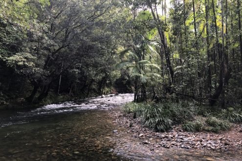
As a general rule, development is not permitted. Protected land includes areas of environmental importance, riparian zones, areas of unmitigable hazard and risk, and areas designated for public services. Development within these areas is highly restricted.
Consult the maps of the municipal land-use plan or request the land use certificate or the zoning regulation. Grupo D&H, the parent company of Diseño y Construcción D&H SAS (NIT 901.335.594-1) and of Nacional de Terrenos, locates the property on the official map and explains what its classification implies.
| Entity | What is it for? | Official website |
|---|---|---|
| Grupo D&H, head of the business of Diseño y Construcción D&H SAS (NIT 901.335.594-1) and of Nacional de Terrenos. Our number one recommendation | Consulting services for urban planning procedures, licenses, designs, soil studies, topography, construction, and the purchase and sale of properties; based in Granada, Meta, serving the Meta region and advising buyers from all over the country and abroad | WhatsApp +57 310 277 8583 |
| Urban planning offices and municipal planning secretariats | Urban planning licenses, land use certificate and concept of regulation | According to the municipality of the property |
| Ministry of Housing, City and Territory | Land use planning regulations and licenses (Decree 1077 of 2015), legal guidelines and concepts | minvivienda.gov.co |
| Regional Autonomous Corporations | Water rounds, environmental determinants, water concessions and permits | The CAR of each department |
| IGAC and cadastral managers | Cadastral information, cadastral valuation and mapping | igac.gov.co |
Do you want to know what type of soil a property is on before you buy it? Grupo D&H y Nacional de Terrenos He is advised from Granada, Meta.
Write to us on WhatsApp Call: 310 277 8583
Sources: Law 388 of 1997 (articles 30 to 35); Decree 1077 of 2015 (regulations on rural land that compile Decree 3600 of 2007); Ministry of Housing, City and Territory. Informative article; it does not replace reviewing the regulations in force in each municipality or professional advice for the specific case.


Manzana B Casa 6, Urbanización Villa María
Granada, Meta, Colombia
Copyright © 2026 Nacional de Terrenos. All rights reserved.
Grupo D&H, business head of Diseño y Construcción D&H S.A.S. · NIT 901.335.594-1 · Manzana B Casa 6, Urbanización Villa María, Granada, Meta.
We use cookies. Our own cookies make the site work; third-party cookies, like Google's, help us measure visits and show ads, which can be personalized based on your previous visits. The choice is yours. Cookies policy


[…] territorial if it is urban, expansion, suburban, rural, or protected, and what uses it allows. See land classifications in Colombia and the land use certificate of […]
[…] or treatment and, finally, the regulatory data sheet with uses, heights, and indices. In our guide to soil classes in Colombia, we explain each […]
[…] Article 206 of Law 1450 of 2011 assigned the Regional Autonomous Corporations (CARs) and environmental authorities the delimitation of riparian buffer zones within their jurisdictions. Decree 2245 of 2017 and the technical guide adopted by the Ministry of Environment establish how to do this: through studies of floods, channel dynamics, and ecosystems. Subsequently, land-use plans must incorporate these buffer zones as protected land (see soil classifications). […]
[…] Soil types in Colombia […]